How Do Scientists Investigate Whether Humpback Whales Change Their Routes Within Samaná Bay?
Humpback whales visit the waters around Samaná Bay in the Dominican Republic during the North Atlantic breeding season. While whale watching often focuses on dramatic breaches, tail slaps, and close encounters, scientists are interested in another question: Do humpback whales follow consistent routes within the bay, or do their travel paths change over time?
Understanding whale movement can help researchers investigate habitat use, identify possible travel corridors, and evaluate how changing environmental conditions or human activity might influence whale behavior.
However, observing a whale at two different locations does not automatically reveal the exact route it followed between them. Researchers must combine repeated observations, individual identification, location records, and careful analysis to investigate movement patterns.
This guide explains the methods scientists can use to study humpback whale routes in Samaná Bay without assuming that every possible route has already been documented locally.
Why Study Humpback Whale Routes in Samaná Bay?
A bay is not simply a single, uniform area of water. Its coastal shape, water depth, currents, vessel activity, and environmental conditions can vary from one location to another.
Humpback whales may travel between different parts of a bay while resting, socializing, accompanying calves, or moving toward another destination. Their paths may also differ between individuals and across observation periods.
Studying these movements can help scientists investigate several questions:
- Do individual whales repeatedly travel through the same corridors?
- Do whales take different paths on different days?
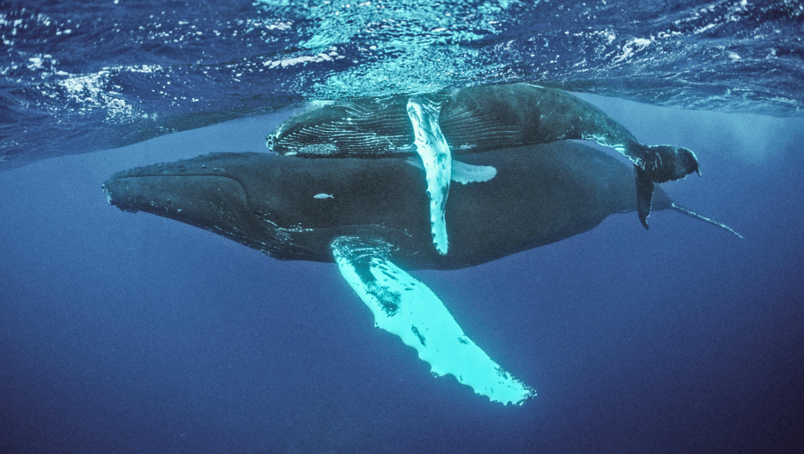
- Are movement patterns different for mother-and-calf pairs and other whales?
- Do routes appear to change with tides, currents, or weather?
- Are observed route changes associated with boat traffic or other disturbances?
- How much of a whale's actual journey remains unknown between sightings?
These are research questions, not established conclusions about every whale in Samaná Bay. Reliable answers require appropriately collected observations and evidence.
1. Recording Whale Locations at Different Times
The first step is to establish where a whale was observed and when the observation occurred.
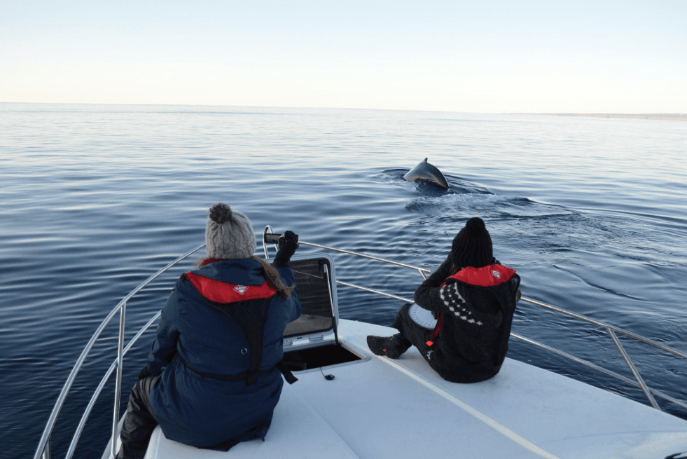
Researchers or trained observers can record the location of a sighting using GPS coordinates, along with the date, time, observation conditions, and relevant behavioral information.
A single location provides only one point in the whale's journey. Repeated locations collected over time can begin to reveal a movement pattern.
For example, imagine a hypothetical whale recorded at one location in the morning and another location later that day. If additional observations establish its direction of travel, researchers may be able to infer part of its route.
However, two locations alone do not establish the exact path taken between them. The whale could have followed several possible paths, including one that was never observed.
For this reason, researchers need repeated observations and must document the uncertainty between recorded positions.
2. Identifying Individual Whales
One of the biggest challenges in studying movement is determining whether sightings on different occasions involve the same animal.
If researchers mistake two different whales for one individual, they may construct a false route. Conversely, if they fail to recognize the same whale in multiple photographs, they may overlook a genuine movement pattern.
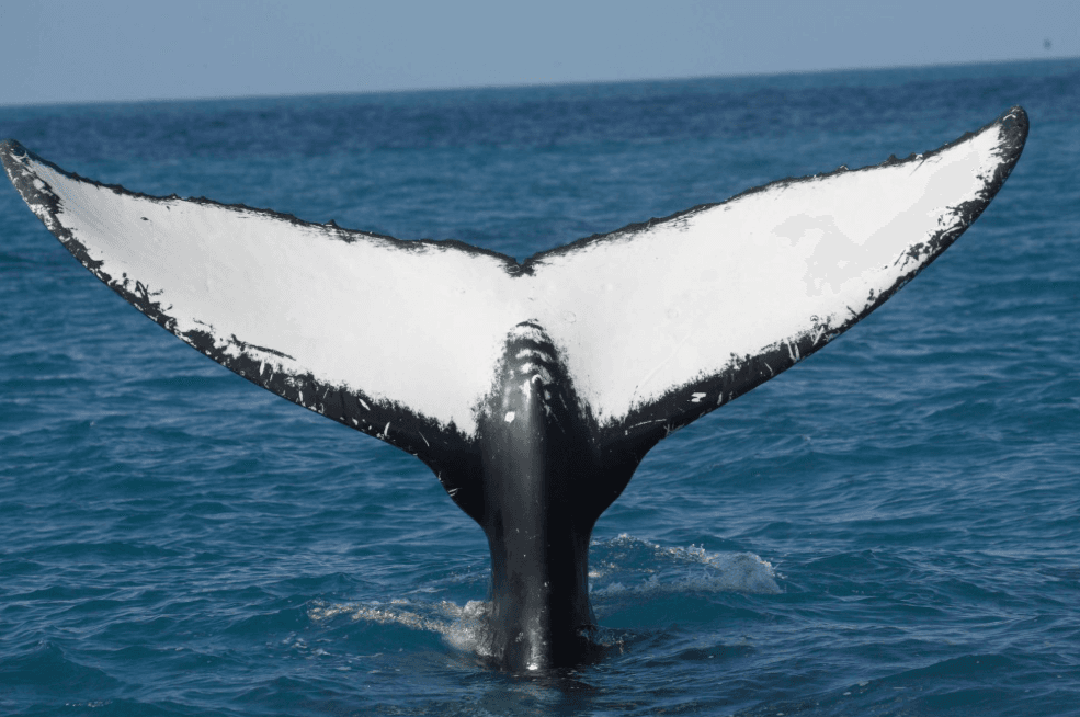
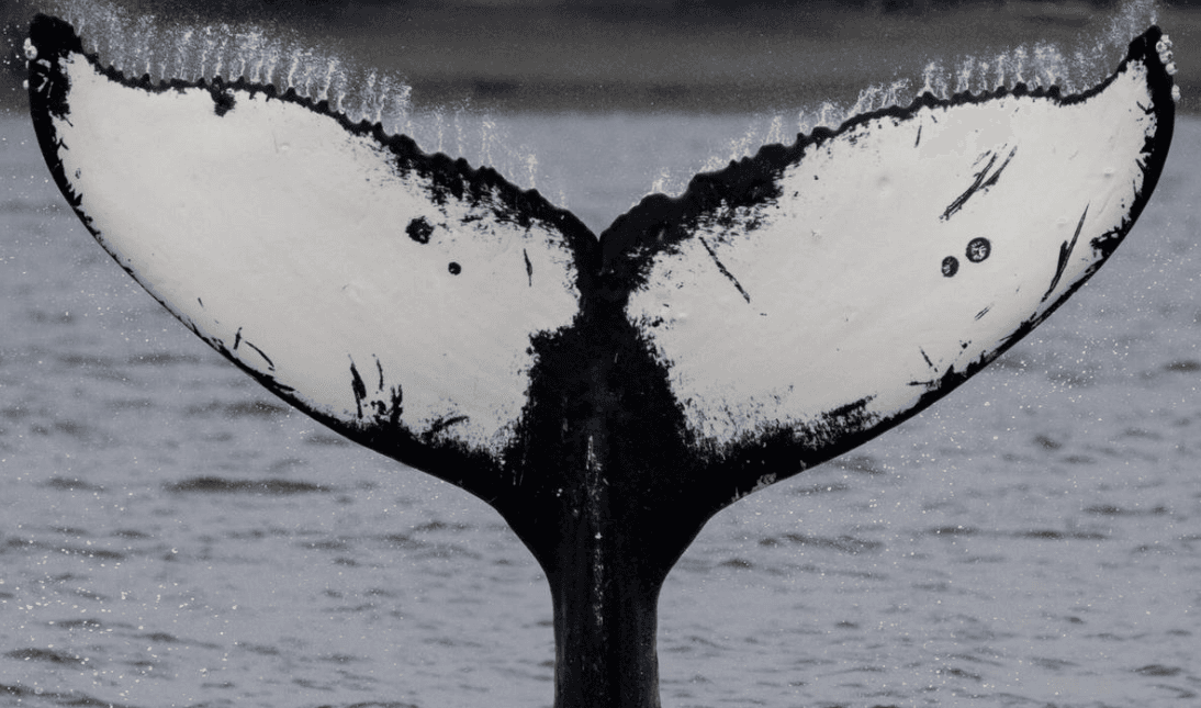
Humpback whales can often be identified using photographs of their tail flukes. The patterns of pigmentation, scars, and other markings may help researchers match individuals across encounters.
Researchers may also record other identifying features and use established photo-identification procedures to assess how confidently two sightings can be matched.
Individual identification is especially useful when studying whether a whale repeatedly uses a particular corridor or moves between different areas during a season.
Even with good photographs, identification is not always certain. Poor lighting, distant sightings, partial images, and changes in viewing angle can reduce confidence.
3. Building a Timeline of Observations
After identifying sightings and matching individual whales where possible, researchers can organize the records chronologically.
A movement timeline may include:
- The date and time of each observation.
- The whale's recorded position.
- The direction of travel, when it can be established.
- Whether the whale was traveling, resting, socializing, or engaged in another observable activity.
- The number of other whales nearby.
- Weather, visibility, and observation effort.
- The confidence associated with the identification and location.
This timeline helps researchers distinguish a series of isolated sightings from a more informative sequence of observations.
For example, a whale seen at several locations over a short period may provide stronger evidence of a route than a whale seen at two locations several weeks apart. The longer gap leaves more uncertainty about what happened in between.
A timeline should also record gaps in observation rather than treating missing data as evidence that the whale did not move.
4. Mapping Possible Travel Routes
Geographic information systems (GIS) and mapping software can help researchers visualize whale sightings and investigate possible movement corridors.
Scientists can place recorded positions on a map, connect observations in chronological order when the individual match is reliable, and compare movement sequences from different observation periods.
Several mapping approaches may be useful:
Sequential sighting maps: Show the order in which a whale was observed at different positions.
Track maps: Display a reconstructed path when sufficiently frequent and reliable position data are available.
Movement corridor maps: Highlight areas through which multiple recorded paths appear to pass.
Uncertainty maps: Show where location data are sparse or where alternative routes remain possible.
These products answer different questions. A map showing many sightings in one area does not necessarily demonstrate that whales travel through that area along a particular route. Establishing a route requires evidence about movement over time.
When sightings are separated by long gaps, straight lines between positions should not be presented as the whale's exact path. Such lines may be useful as simplified illustrations, but they are not direct observations of the journey.
5. Comparing Routes Across Different Days
To investigate whether routes change, scientists need to compare movement records from different observation periods.
A whale might follow one apparent path on one day and another path on a later day. Researchers would examine whether the difference is supported by sufficient observations and whether the routes are genuinely comparable.
They may compare:
- The sequence of locations visited.
- The direction and timing of travel.
- The length of the observed movement sequence.
- The areas used at different stages.
- The amount of time between recorded positions.
- The quality and completeness of each observation period.
Researchers should also consider whether different routes reflect actual behavior or simply differences in observation coverage.
For example, if a research team watches one section of the bay more closely on one day, it may record a different apparent route even when the whale's underlying behavior has not changed.
Reliable comparisons therefore require transparent methods and careful consideration of sampling limitations.
6. Investigating Environmental Influences
Whale routes may be influenced by environmental conditions, although the importance of any particular factor must be tested rather than assumed.
Scientists can compare movement observations with environmental measurements collected at relevant times and locations.
Potential variables include:
- Tides and currents: Water movement may affect travel conditions and the direction a whale takes.
- Water depth and coastal geography: Physical features may shape the available pathways through an area.
- Weather and visibility: Conditions can influence both whale observations and researchers' ability to follow animals.
- Prey distribution: Feeding opportunities may influence movements in some contexts, although breeding-season movement should not automatically be interpreted as feeding behavior.
- Social activity: Encounters with other whales may coincide with changes in direction or travel patterns.
To evaluate an environmental relationship, scientists need repeated observations, appropriate measurements, and analysis that considers alternative explanations.
If a route changes during a period of strong currents, for example, that coincidence alone does not prove that currents caused the change. Other conditions may also have differed.
7. Studying the Movement of Mother-and-Calf Pairs
Mother-and-calf pairs can be especially interesting to researchers because their movement patterns may differ from those of other whales.
Scientists can record the locations and movements of identified pairs, document changes in their spacing and behavior, and compare their observed routes with those of other groups.
However, researchers should avoid assuming that every mother-and-calf pair follows the same pathway or that a particular route is necessarily a protective strategy.
A convincing comparison would require enough observations across different pairs and periods to separate recurring patterns from individual variation.
Researchers must also consider that following whales too closely could disturb them. Studies should use appropriate observation distances, ethical procedures, and applicable wildlife regulations.
8. Investigating Whether Boat Traffic Coincides With Route Changes
Whale-watching vessels and other marine traffic make vessel activity a relevant subject for movement research.
Scientists could record vessel locations, distances from observed whales, traffic intensity, whale behavior, and changes in travel direction. They could then investigate whether route changes occur more frequently under particular vessel conditions.
This type of research must distinguish correlation from causation.
A whale changing direction near a boat does not, by itself, establish that the vessel caused the change. The animal might have been turning for another reason, or the boat might have approached after the whale had already changed course.
Useful analyses require accurate timing, adequate comparison observations, and methods that account for other factors.
Responsible whale watching should follow applicable regulations and established guidance for minimizing disturbance, regardless of whether a specific behavioral response has been documented.
9. Understanding the Limits of Route Reconstruction
Researchers cannot always observe a whale continuously. Animals may dive, travel beyond the observers' field of view, or move through areas where visibility is limited.
Several limitations can affect route studies:
Incomplete sightings: A whale may be recorded only at the beginning and end of a journey.
Identification uncertainty: Similar-looking or poorly photographed whales may be confused.
Uneven survey coverage: Some locations or times may receive more observation effort than others.
Changing conditions: Weather and sea state can affect the accuracy and frequency of sightings.
Gaps between surveys: A whale may have changed direction several times between recorded observations.
Unobserved animals: Researchers cannot automatically assume that whales not seen during a survey were absent from the area.
Scientists can address these challenges by recording observation effort, assigning confidence levels to identifications, using suitable statistical methods, and explaining uncertainty when presenting maps and conclusions.
Where feasible and justified, methods such as satellite tagging may provide more continuous movement information. Tagging requires appropriate permits, animal-welfare safeguards, technical expertise, and a clear scientific justification; it is not necessary or suitable for every study.
10. How Route Research Can Support Whale Conservation
Understanding movement pathways can contribute to marine conservation planning.
If repeated, reliable observations indicate that whales use a particular corridor, that information may help researchers and relevant authorities evaluate potential risks from vessel traffic or other human activities.
Route studies can also identify gaps in scientific knowledge and help design future surveys. Researchers may discover that certain locations need more consistent observation or that existing data are insufficient to distinguish between alternative movement patterns.
However, a route map should not automatically be treated as a complete picture of whale habitat use. A whale may travel outside a mapped corridor, and an area with few recorded routes may simply have received less observation effort.
Conservation decisions should therefore combine movement evidence with other relevant information, including habitat characteristics, whale behavior, vessel activity, and the uncertainty in the available data.
Frequently Asked Questions
Do humpback whales follow the same routes through Samaná Bay every year?
That cannot be assumed for every whale. Researchers would need comparable observations across multiple seasons and years to determine whether individuals or groups repeatedly use similar pathways.
How do scientists know whether a whale has changed its route?
They compare reliable location records collected over time, ideally for the same identified individual. They also examine observation gaps, environmental conditions, and the possibility that apparent differences result from uneven survey coverage.
Can photographs reveal a whale's complete route?
No. Photographs can help identify individual whales and establish where they were observed, but they usually cannot reveal every part of the journey between sightings.
Do whale-watching boats cause humpback whales to change direction?
A change in direction near a boat does not prove causation. Researchers need timed observations, information about vessel activity, and appropriate comparisons to investigate whether vessel presence is associated with movement changes.
Are GPS trackers required to study whale routes?
No. Researchers can study movement using repeated sightings, photo-identification, GPS records from observation vessels, and mapping methods. Tracking devices may provide additional information in some studies but require careful ethical and scientific consideration.
Why are route maps useful for conservation?
They can help researchers investigate travel corridors, evaluate possible interactions with human activities, identify research gaps, and inform evidence-based management. Their usefulness depends on the quality and representativeness of the underlying data.
Conclusion
Investigating humpback whale routes in Samaná Bay involves more than marking sightings on a map. Scientists need reliable location records, individual identification, chronological observations, and methods for comparing movements while accounting for uncertainty.
Environmental conditions, social behavior, and vessel activity may all be relevant to route research, but their influence must be evaluated using appropriate evidence.
The most valuable route maps are not necessarily the ones with the most lines. They are the ones that clearly distinguish observed movements from inferred paths and explain what the available evidence can—and cannot—show.
As research continues, better movement records may help improve understanding of how humpback whales use Samaná Bay and how their habitat can be protected responsibly.

Local explorer & expert guide in Isla Saona Oficial.